6-8 hours
Duration
18.5 km
Distance
1200m
Elevation Gain
3317m
Max Elevation
July - September
Best Time
Low
Crowd Level
About This Trail
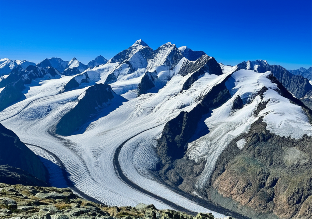
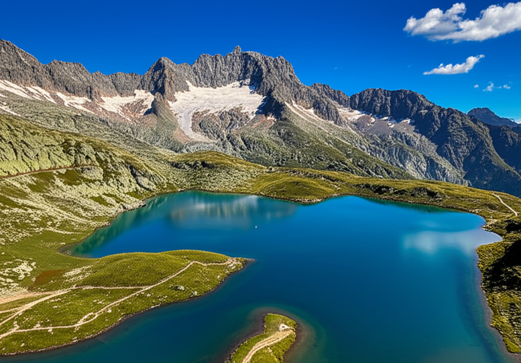
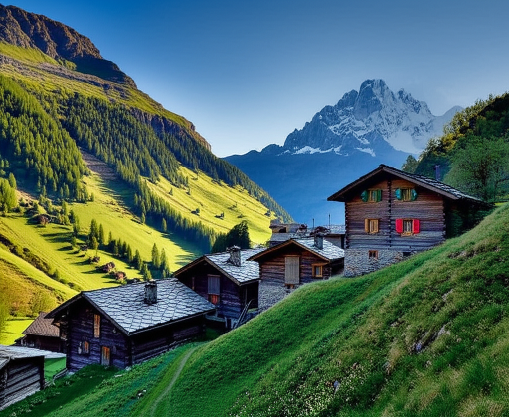
This challenging circuit around Monte Rosa, the second-highest mountain in the Alps, takes you through some of the most dramatic high-altitude terrain in Europe. Starting from Alagna Valsesia, the trail winds through ancient glacial valleys, past pristine alpine lakes, and up to high mountain passes with breathtaking views of the Monte Rosa massif. The route requires excellent fitness and mountain experience, but rewards hikers with unparalleled alpine scenery and a true wilderness experience.
Trail Highlights
Views of 4000m peaks and glaciers
High-altitude alpine lakes
Traditional Walser villages
Pristine wilderness experience
Mountain hut accommodations
Challenging mountain passes
Photo Gallery